Thousands of homes were without power around Reno Tuesday as another early winter storm packing winds more powerful than the last one started blowing into the Sierra.
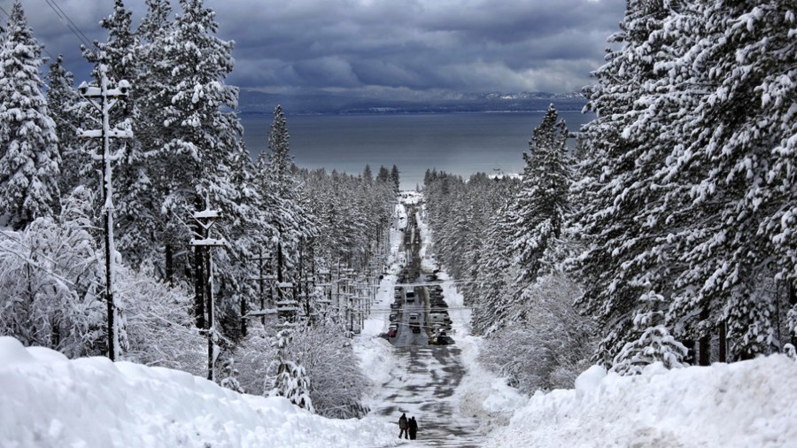
More than a foot (30 centimeters) of snow is possible in the mountains around Lake Tahoe by Wednesday.
The National Weather Service in Reno has upgraded a winter storm watch to a storm warning for the Tahoe area effective from 4 p.m. Tuesday through 6 p.m. Wednesday. Winds topping 100 mph (160 kph) are possible over the ridgetops of the Sierra.
“Travel could be very difficult. Very strong winds could cause extensive tree damage,” the service said.
“To give this wind event perspective, it is expected to be stronger than the one experienced last Friday,” when gusts reached 111 mph (178 kph) at the top of Squaw Valley ski resort near Truckee, California, and 106 mph (175 kph) at Peavine Peak in Reno, service forecasters said.
NV Energy reported about 10,000 customers were without power Tuesday afternoon in the Reno and Carson City areas.
But about 6,000 of those were in a suburban part of southwest Reno, where fire crews were battling a wildland blaze in dangerous winds gusting to near 50 mph (80 kph). It wasn’t immediately clear if the outages were caused by downed power lines or if crews had cut off power intentionally in some areas due to the fire that was threatening structures.
There were no immediate reports of damage or injuries.
At Lake Tahoe, up to a half-foot (15 cm) of heavy, wet snow is expected at lake level by Wednesday, with winds gusting to 60 mph (96 kph). Between a foot and 18 inches (30 and 45 cm) of snow is possible at elevations above 7,000 feet (2,133 meters).
The service warned of hazardous boating conditions on the lake, where waves are expected on the northern waters from 3 to 6 feet (91 cm to 1.8 meters).
Elsewhere, a wind advisory remains in effect into Wednesday afternoon for much of central and northern Nevada from California to Utah and as far south as Beatty, about 110 miles (177 kilometers) northwest of Las Vegas, where wind gusts up to 45 mph (72 kph) are possible.
There is a winter weather advisory through 6 p.m. Wednesday in the Sierra north of Reno-Tahoe. Six inches (15 cm) of snow and winds gusting to 70 mph (112 kph) are in the forecast near Susanville, California, where the service said blowing snow could reduce visibility at times Tuesday evening into Wednesday.
A secondary wave of stormy weather will begin to move through Northern California on Wednesday, which should result in snow.
A weak area of low atmospheric pressure should move through the region Thursday into Friday with a few lingering showers in the Tahoe Basin and points north. Snow levels will be down close to valley floors in these areas, so light accumulation is possible, mainly before and shortly after daybreak Thursday, the service said.