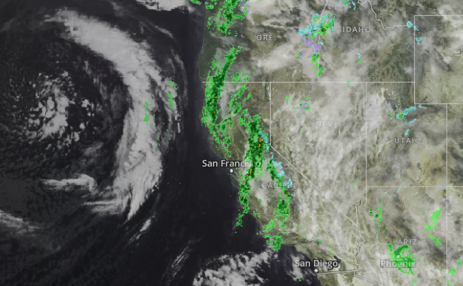
California is bracing for the impacts of a storm that is expected to dump several inches of rain in many urban areas and heavy snow in the mountains.
The atmospheric river event will first produce light to moderate rainfall along the West Coast during the day on Tuesday before the arrival of a second, more powerful front, according to the National Weather Service.
Through Wednesday and Thursday, the Weather Service is forecasting rain that will be “moderate to heavy at times,” and will bring the potential for flooding.
“The associated heavy rain will create mainly localized areas of flash flooding, with urban areas, roads, small streams, narrow canyons/gullies, and burn scars the most vulnerable,” NWS said in a bulletin.

In Southern California, two to four inches of rain is expected Tuesday night through Friday along the coastal areas and inland valleys, including metro Los Angeles. Four to eight inches of rain is forecast for the foothills and mountains, especially south-facing slopes.
San Diego County can expect rain totals of two-and-a-half to three inches before the skies clear on Friday.
In the San Francisco Bay area, meteorologists expect a half-inch to an inch of rain each day on Tuesday and Wednesday.
“Isolated thunderstorms are also likely throughout this atmospheric river event,” says KTLA 5 weather anchor Kirk Hawkins.
Locally heavy snow is expected in the mountains above 7500 feet, including the Sierra Nevada and San Bernardino mountains.


