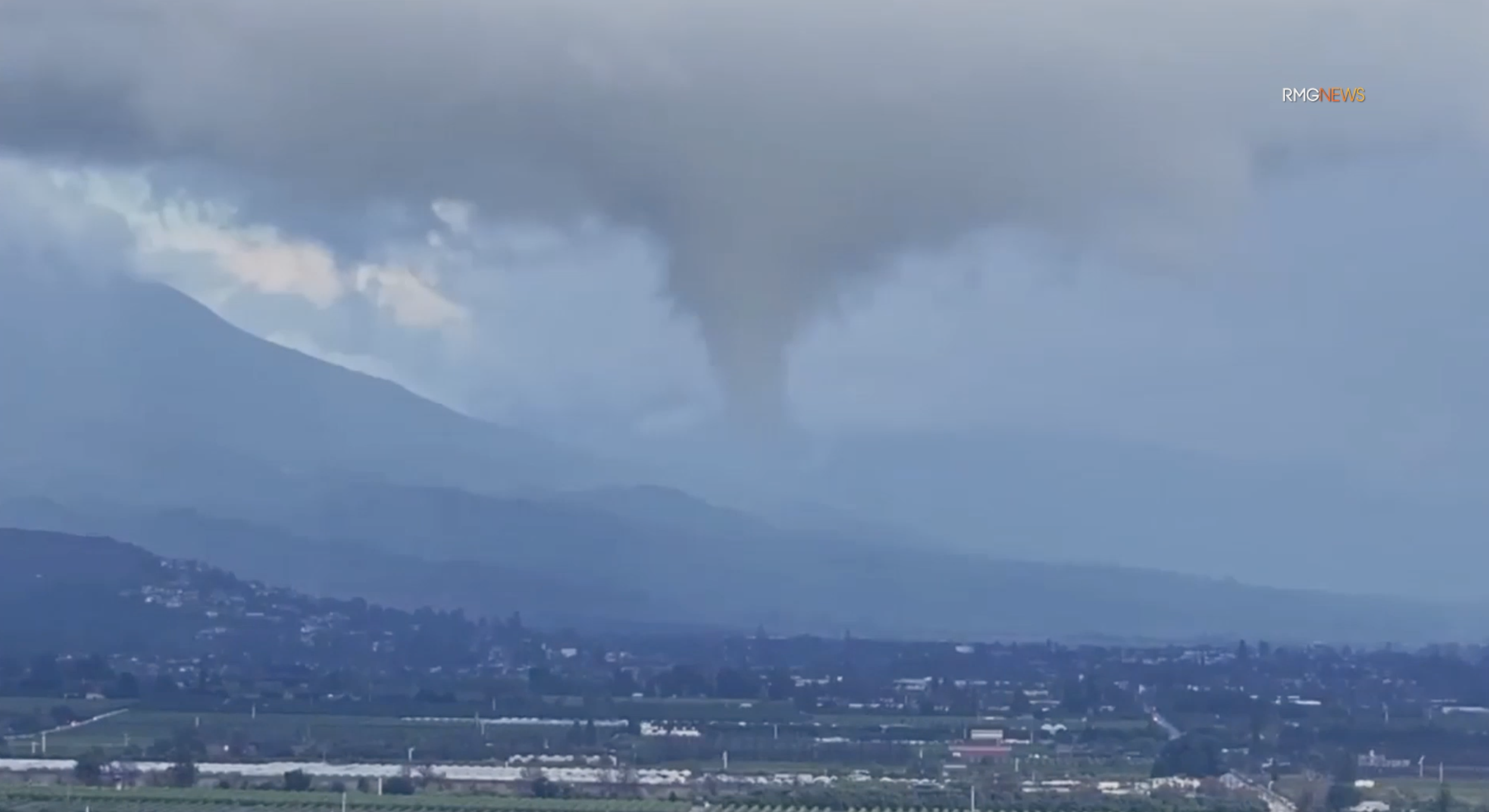
Video captured a dramatic funnel cloud Tuesday over a portion of Ventura County.
Spotted in a dark and foreboding sky at around 4 p.m., the funnel appears to be swirling over the top of structures near the foothills in Santa Paula.
Funnel clouds, according to the National Weather Service, are caused by “vertical stretching” or what’s called vorticity, which can be thought of as “spin” in the atmosphere created by wind shear.
When vorticity is stretched vertically, the area of rotation shrinks causing the spinning air to speed up, not unlike a twirling ice skater who spins faster when they pull their arms in.
Tornadoes differ in that the rotation of the funnel is in contact with both the ground and the base of the cloud at the same time.
The stronger atmospheric-river storms that battered Southern California in early February produced two confirmed tornadoes that touched down in San Luis Obispo, the first in nearly 20 years.
Meteorologists with the NWS said it had received unconfirmed reports of at least one tornado touching down near the cities of Pismo Beach and Grover Beach.
The agency later confirmed that two tornadoes had touched down on the Central Coast.
After seeing images of the funnel over Santa Paula captured by RMG, a news video service, and looking back at radar, officials at NWS told KTLA that there was rotation seen in a cell this afternoon, but nothing could have been warned against ahead of time.
So far, there have been no reports of any damage caused by the funnel cloud.