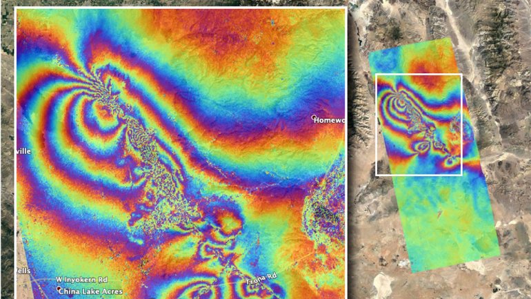
Damage to the earth’s crust from the magnitude 6.4 and 7.1 earthquakes that struck Southern California last week is visible in a kaleidoscopic satellite image released by NASA.
The Advanced Rapid Imaging and Analysis team at NASA’s Jet Propulsion Laboratory in Pasadena used satellite data to produce a map showing ruptures and displacements not visible to the naked eye — employing technology that has been developed over the last quarter of a century. The imagery was acquired on July 8 and compared with data from April 8.
The earthquakes were the largest to hit California in nearly 20 years and were felt as far away as Phoenix and Mexicali, Mexico. The temblors and the thousands of aftershocks that followed did not lead to major structural damage near the Ridgecrest epicenter but did have residents of nearby Trona, Calif. worrying about their town’s future.
Authorities were investigating whether the death of a man 95 miles away in Pahrump, Nev., was tied to the earthquake. The man was pinned under a Jeep after the vehicle fell off its jacks.
Read the full story on LATimes.com.


