Following the hottest October ever recorded in parts of Southern California, the season’s first major storm brought rain, gusty winds and even a light dusting of snow to the Big Bear and Mountain High areas, resort officials and the National Weather Service said Tuesday.

The cold front first moved across California on Monday, bringing temporary relief from drought conditions and the unusually warm start to the fall season.
The wintery weather included some snowfall in the Big Bear and Mountain High areas, where resort officials hoped for a colder season than last year when some resorts were forced to close early, and lost revenue.
“This is a great start for snowmaking,” said Big Bear resort official Clayton Shoemaker. “We got a feeling mother nature is going to kick in this year. We’re pretty excited.”
Despite the optimism, it was not yet known when the areas would be open to winter-sports lovers.
Light dusting received last night at the top of our West Resort. More @ https://t.co/ua2CWy5aIW #WinterIsComing pic.twitter.com/21HzTzZYuB
— Mountain High (@mthigh) November 3, 2015
Farther north, 12 to 30 inches of fresh snow was recoded in the Mammoth Mountain area, which announced online Tuesday it would open in two days.
Heavy coats of much-needed snow could also be seen in parts of the Sierra Nevada after Monday’s storm, photos from Caltrans showed.
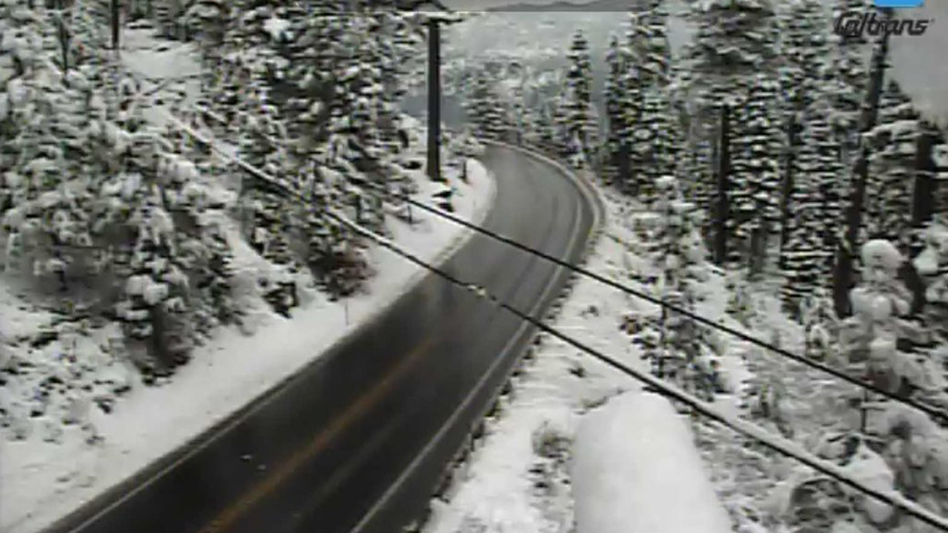
The area recoded its lowest snowpack in about 500 years earlier this year amid the ongoing drought. Weather experts told the Los Angeles Times the snowfall was good news since the Sierra Nevada’s snowpack typically provides California with a third of its water supply.
Temperatures dropped nearly 20 degrees in parts of the southland on Monday as compared to the weekend, and the cooler weather was predicted to continue Tuesday with temperatures likely to reach 30 to 40 degrees across higher terrains and 60 to 70 degrees in coastal and valley areas, the Times reports.
A slight chance of rain, gusty winds and high surf conditions was predicted in Los Angeles County Tuesday, with a 20 percent chance or showers and possibly thunderstorms hitting areas such as downtown L.A. and the San Fernando Valley after 10 a.m., according to the weather service.
Wind and high surf advisories were also issued for much of the county on Tuesday, with gale force winds “likely” to hit the coastal areas, according to the weather service.
More than a tenth of an inch of rain was recorded Monday in areas such as Pasadena, Palmdale and Lancaster.
More rainfall was recoded in L.A.’s mountain areas, but it was not believed to have surpassed an inch of rainfall as of Monday night.


