The National Weather Service has released a detailed forecast for the arrival and intensity of rain associated with Tropical Storm Hilary.
Hilary, which reached Category 4 strength on Friday, was downgraded to a tropical storm Sunday morning. Rainfall in Los Angeles, Orange, Riverside, Ventura and San Bernardino counties will intensify throughout the day.
“The peak of the storm will likely occur between 4 p.m. today and 4 a.m. Monday. This is a major and very dangerous storm with rainfall and flooding the preeminent threat,” NWS said in a bulletin Sunday morning.
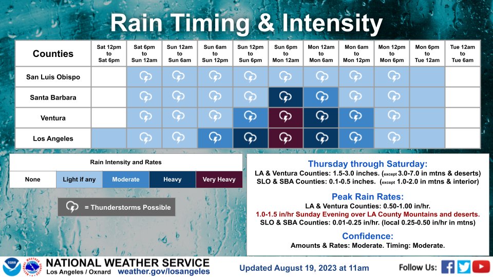
Peak rain rates will be .50 to 1.0 inches per hour with higher amounts in the mountains and deserts.
NWS meteorologist Elizabeth Adams said rain could fall up to 3 inches an hour across Southern California’s mountains and deserts, from late Sunday morning into the afternoon, which could cause widespread and life-threatening flash floods.
Hilary will continue to drench the region into Monday afternoon when rain begins to taper off, according to the NWS.
Rainfall total estimates through Monday are 1.5-3 inches for most coastal/valley areas in L.A./Ventura counties, with 3 to 7 inches possible in the L.A. County mountains and Antelope Valley.
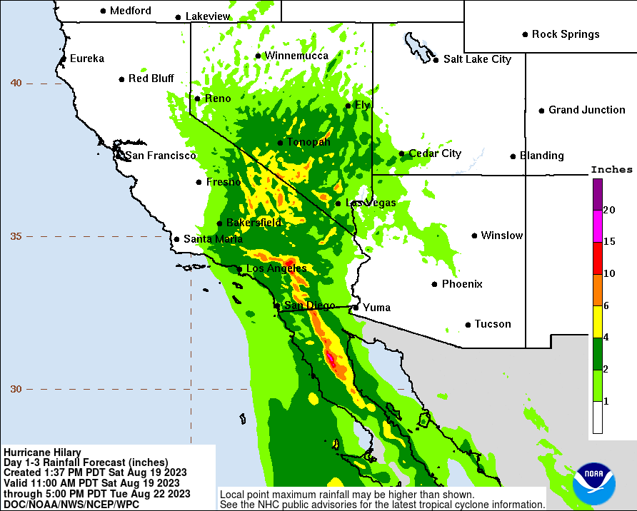
“Prepare for life-threatening flooding of small streams, creeks, arroyos, and ditches, as well as debris flows in burn scars,” NWS said. “In addition, there will be the threat of rock and mudslides, especially in the mountains and canyons. Significant roadway flooding will be possible, causing dangerous driving conditions.”