This is an archived article and the information in the article may be outdated. Please look at the time stamp on the story to see when it was last updated.
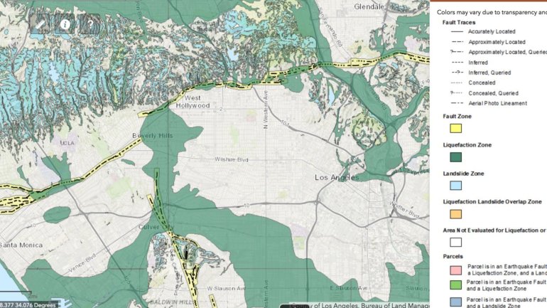
Earthquake faults run along stretches of Santa Monica Boulevard on the Westside and into Hollywood. LIquefaction zones spread across the region. Landslide zones are in hilly areas. (Credit: California Geological Survey)

It’s now way easier to find out if you live in a California earthquake fault zone.

The California Geological Survey has published an easy-to-use interactive map online — type in your address or share your location on your smartphone, and, voila, you’ll know if you stand in a fault zone.

Or, for that matter, a place at risk of liquefaction or a landslide unleashed by an earthquake.

What these three zones have in common is the risk the ground can break in an earthquake, and not just be shaken.

Read the full story on LATimes.com

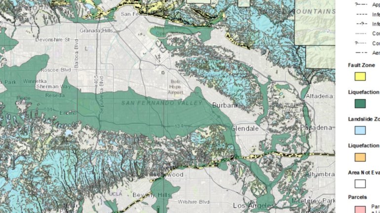
The southern half of the San Fernando Valley, which neighbors the Los Angeles River, is a large liquefaction zone, shown in green. Many mountainous and hilly areas, such as the Santa Monica Mountains, are at risk of earthquake-induced landslides, shown in aqua. (Credit: California Geological Survey)
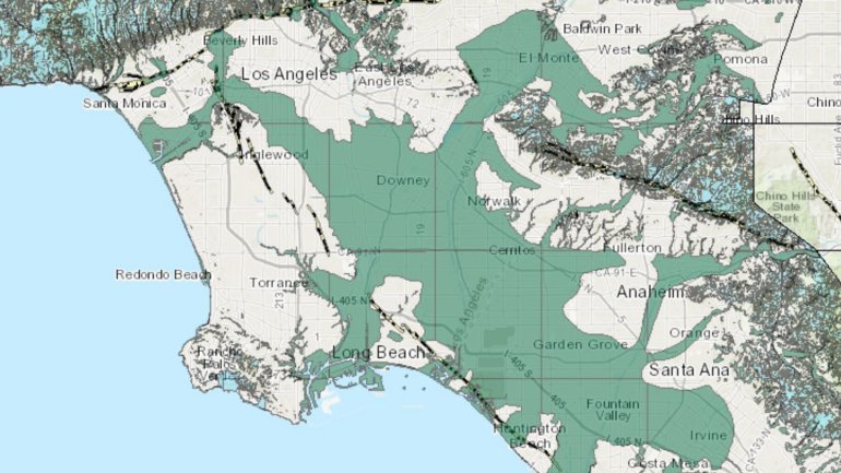
Large swaths of the Los Angeles Basin and Orange County are in a liquefaction zone. (Credit: California Geological Survey)