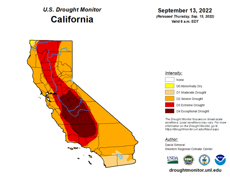
As of Thursday, 99.77% of California is experiencing drought, according to tracking by the U.S. Drought Monitor. Just one (very small) corner of the state is left out.
The drought map of California shows shades of orange, red, and even dark burgundy for the driest parts of the state. But if you look to the far northwest, where the state borders Oregon and the Pacific Ocean, there’s a tiny patch of yellow to be found in Del Norte County.

Del Norte County, with a population around 28,000, is perhaps best known for its lush coastal redwood forest. About two-thirds of the county is experiencing drought, but one-third – the furthest northwest sliver of the county – is not. That small area accounts for the entirety of California’s 0.23% of drought-free territory.
Even still, that part of Del Norte County isn’t exactly in the clear. It’s classified as “abnormally dry” – just one step below “moderate drought” on the Monitor’s severity scale.
Outside the northwest, the least drought-stricken part of the state, counterintuitively, is all the way at the southern border. San Diego and Imperial counties are both primarily in “moderate drought,” faring much better than their neighbors to the north. The area has seen some monsoonal summer rain, which could be helping them out.
The dark, almost maroon shade of red over the Central Valley on the map makes up the 17% of California in the worst drought category: exceptional drought.
As the National Weather Service predicts a 91% chance La Niña will continue through the fall, and possibly even through the winter, there’s concern it will bring even more dry skies over California.


