Southern California and the Central Coast are drying out and cleaning up from a powerful Pacific storm that brought record rainfall to some areas.
Roadways were flooded or washed out entirely by debris and mud. The storm toppled large trees, eroded hillsides and roads, and led to several dramatic rescues as drivers became trapped.
Residents of Montecito, a town adjacent to Santa Barbara that was once devastated by mudslides exactly five years prior, were allowed to return to their homes Tuesday after mandatory evacuation orders were lifted.
By early afternoon, many busy highways that connect the Central Coast to Southern California were also reopened.
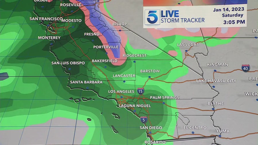
While the Central Coast and Southern California will see a break in precipitation over the next several days, rain returns to the forecast this weekend.
The National Weather Service said two more storm systems will move into the region beginning Saturday and will stay through Monday.
“The Saturday storm will be considerably weaker than this last storm but still an above average winter storm with regard to precipitation amounts,” NWS said in a bulletin.

Lower elevations could experience around one inch of rain Saturday, while higher elevations could see two to three inches.
Temperatures will be lower during Saturday’s storm, meaning snow could fall at as low as 4500 feet.
Sunday will see a weaker system approach the area and remain overnight. The NWS warns that while rain rates could be lower, this storm could remain in the area longer, possibly into Tuesday.


