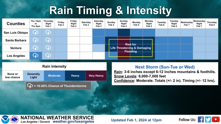
As Southern California prepares for a second, stronger round of storms this weekend, cleanup efforts are underway in many areas.
The flooding that affected multiple roads was likely caused by clogged drains, and with as much as a foot of rain possible in some areas, the clock is ticking with the next round of storms arriving Sunday and sticking around until Tuesday or Wednesday.
According to the National Weather Service, 3 to 6 inches of rain is expected in most areas, though mountains and foothills could get between 6 and 12 inches. There’s a 10% to 20% chance of thunderstorms as well.

Snow levels will be around 6,000 to 7,000 feet, and the NWS called the snowfall “heavy” and added it will be “measured in feet.”
Also expected are “strong and damaging southeast winds,” the NWS said.


