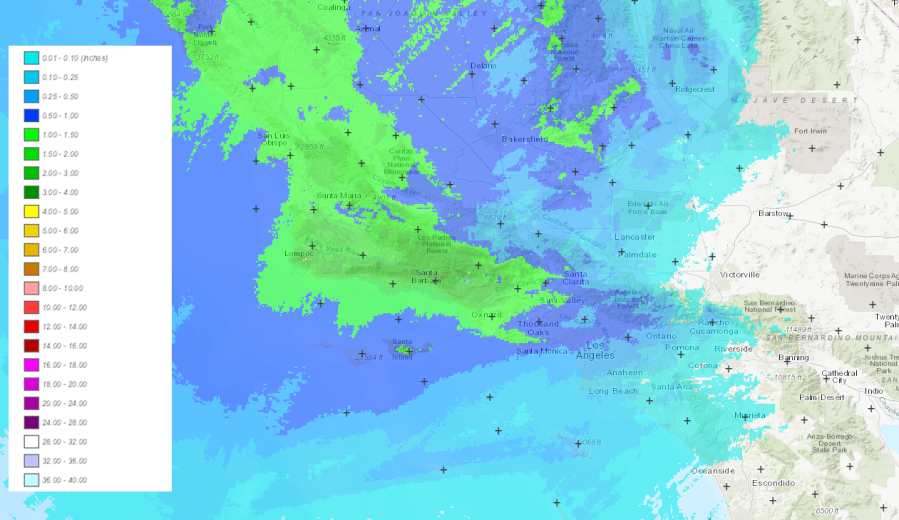
The latest atmospheric river to hit Southern California this winter is expected to dump 2 to 5 inches of rain along the coastal areas and valleys through Wednesday morning. Foothills and mountains could see isolated totals of ten inches.
Here are the official rainfall totals from the National Weather Service as of 8:00 a.m. Tuesday, Feb. 20:
- Saticoy: 4.26″
- Ventura: 4.23”
- La Conchita: 4.01″
- Ojai: 3.68″
- Oxnard: 3.33”
- Porter Ranch: 3.23”
- Bel Air: 3.22”
- Fillmore: 3.12″
- Beverly Hills: 2.49”
- Camarillo: 2.26”
- Santa Anita Dam: 2.24″
- Woodland Hills: 2.02”
- Santa Monica: 1.93”
- Hollywood: 1.92″
- La Canada Flintridge: 1.79”
- Castaic: 1.77″
- Agoura Hills: 1.76”
- Pasadena: 1.68”
- Thousand Oaks: 1.59″
- Castaic: 1.55”
- Calabasas: 1.52”
- Canoga Park: 1.50”
- Culver City: 1.33”
- Alhambra: 1.27”
- Van Nuys: 1.23″
- Chino Airport: 1.21″
- Rialto: 1.18″
- Ontario Airport: 1.16″
- Downtown Los Angeles: 1.15”
- Norco: 1.14″
- LAX: 1.00”
- Huntington Beach: 0.98″
- Laguna Niguel: 0.79″
- John Wayne Airport: 0.73″
- Temecula: .36″
Santa Barbara County has seen the highest rain amounts:
- KTYD Tower: 11.60”
- San Marcos Pass: 10.91”
- El Deseo: 10.17”
- Tecolote Canyon: 8.71″
- Santa Barbara: 5.07″
- Carpenteria: 4.40″


